Climate of India
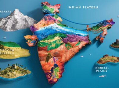
- Different relief features in a vast country like India are responsible for varied climatic conditions
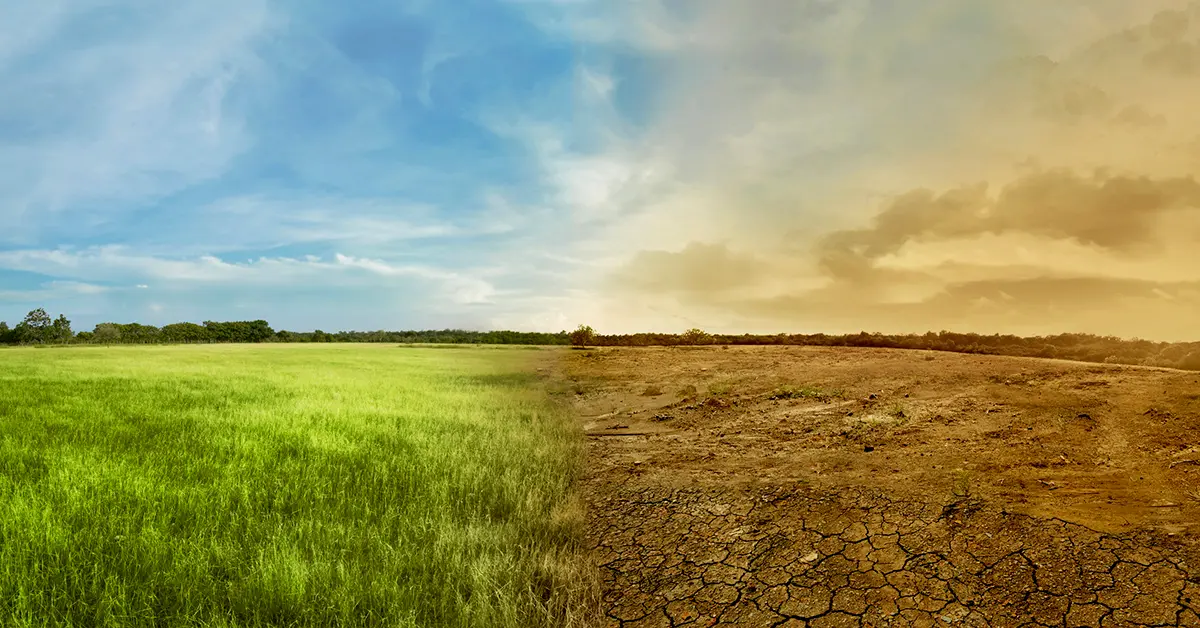
- India has very hot and very cold regions; as well as regions with very heavy rainfall and very scanty rainfall
- The climate of India has been influenced by its position, size and relief features.
- Monsoon winds are the main factors that determine the climate of India.
- A large part of India has tropical monsoon climate
Climatic Seasons of India |
|
| Winter | December to February |
| Summer | March to May |
| Monsoons or Rainy season | June to September |
| Retreating monsoons | October and November |
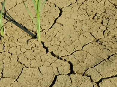
The South west monsoon controls the agriculture of India, which is the main occupation of the people. When the monsoons fail, there is drought, and the crops also fail. When the monsoon is heavy, there are floods causing destruction to life and property.
Distribution of Rainfall in India
- The rainfall in India is seasonal, uncertain and unevenly distributed
- Mainly pours down during the South-West Monsoon period
- On the basis of the quantity of rainfall, we can divide India into five major rainfall regions viz.

| Very low rainfall region |
|
| Low rainfall region |
|
| Moderate rainfall region |
|
| Heavy rainfall region |
|
| Very heavy rainfall |
|
Major factors affecting Indian Climate
- Northward shifting of the Westerly Jet (north of Himalayas)
- Northward shifting of the ITCZ.
- S-E trade winds from S. hemisphere cross the equator and turn right due to coriolis force.
- Latitudinal Extent
- Southern Seas
- Northern Mountains
- El – Nino
- La – Nina
- Westerlies in Northern part of India from Mediterranean (in winters)
- Easterlies due to Heating of Tibetian Plateau
- Jet streams
Indian Monsoon Features
- Unique weather phenomenon
- Seasonal reversal of winds
- Sudden Onset (Sudden rain start)
- Gradual Advance
- Gradual retreat
- Variation – regional and temporal

- Monsoon is seasonal changes in atmospheric circulation and precipitation associated with the asymmetric heating of land and sea
- The southwest monsoon brings rains towards the end of summer as the high pressure built in the Indian Ocean pushes the wind masses towards the low pressure formed on land
- Temperature Gradient > It’s the temperature variation between the sea and the landmass
Summer Monsoon in India (SW Monsoon)
- Originates due to Northward shift of ITCZ > SE trade winds cross equator > Deflect & enter into India as SW Monsoon
- Easterly Jet Stream / SE Monsoon / BOB Monsoon > Due to differential heating of Tibetian plateau & Himalayan region wrt BOB
- The southwest monsoon arrives in two branches: the Bay of Bengal branch and the Arabian Sea branch
- The Bay of Bengal branch, which initially tracks the Coromandal Coast northeast from Cape Comorin to Orissa, swerves to the northwest towards the Indo-Gangetic Plains
- The Arabian Sea branch extends toward a low-pressure area over the Thar Desert and is roughly three times stronger than the Bay of Bengal branch
- The Arabian Sea branch moves northeast towards the Himalayas

Initiation of Summer Monsoon
- The southwest monsoon typically breaks over Indian Territory by around 25 May, when it lashes the Andaman and Nicobar Islands in the Bay of Bengal
- It strikes the Indian mainland around 1 June near the Malabar Coast of Kerala
- By 9 June, it reaches Mumbai; it appears over Delhi by 29 June
- By the first week of July, the entire country experiences monsoon rain
- On average, South India receives more rainfall than North India
- However, Northeast India receives the most precipitation

Withdrawal of Summer Monsoon
- Monsoon clouds begin retreating from North India by the end of August; it withdraws from Mumbai by 5 October
- As India further cools during September, the southwest monsoon weakens. By the end of November, it leaves the country

Arabian Sea Branch
- Strikes WGs + Move parallel to Aravallis & Strike Himalayas
- Rainfall at WGs & Coastal Regions + Northern Plains
- Strikes at Western Ghats; and gives rainfall to the western most regions
- While rain shadow interiors, the Deccan plateau receive very less rainfall.

Bay of Bengal Branch
- Moves parallel with the Eastern Ghats and produce very less rainfall until it strikes at NE.
- Bifurcate at Meghalaya hills & move parallel to Himalaya
- One branch provide rainfall to NE India region
- Another moves westward providing rainfall to northern plains
- Going westward Rainfall Decreases
- Rainfall at Northern East plains + Northern Plains

Retreating or NE Monsoon
- Around September, with the sun fast retreating south, the northern land mass of the Indian subcontinent cool off rapidly
- With this, air pressure begins to build over northern India, but the Indian Ocean and its surrounding atmosphere still holds its heat
- surrounding atmosphere still holds its heat Indo-Gangetic Plain towards the vast spans of the Indian Ocean south of the Deccan peninsula
- This is known as the Northeast Monsoon or Retreating Monsoon


Winter Rainfall in South India
- While travelling towards the Indian Ocean, the dry cold wind picks up some moisture from the Bay of Bengal and pours it over peninsular India and parts of Sri Lanka
- Cities like Madras, which get less rain from the Southwest Monsoon, receive rain from this Monsoon.
- About 50% to 60% of the rain received by the state of Tamil Nadu is from the Northeast Monsoon.
- In Southern Asia, the northeastern monsoons take place from December to early March when the surface high-pressure system is strongest
Jet Streams
- Jet streams are currents of air high above the Earth.
- They at altitudes of about 8 to 15 kilometers, located neartropopause
- The major jet streams on Earth are westerly winds (flowing west to east)
- Flow at very high speeds > 120 kmph in winters and 50 kmph in summers
- Jet streams are caused by a combination of a planet’srotationon its axis and atmospheric heating
- Jet streams form near boundaries of adjacent air masses with significant differences intemperature, such as thepolar region and the warmer air towards the equator
- All year-round westerlies flow over north India south of Himalayas but in summers with shift of the sun they flow north of Himalayas & replaced by easterlies.

Sub-tropical jet stream
- They prevail over the lower latitudes of westerlies.
- It is produced by the rotation of earth and its spherical shape.
- The air over equator has the highest velocity (Coriolis effect)
- As it rises and moves towards north, it has a higher velocity than the air at lower altitude prevailing at same latitude.
- So it begins to flow from west to east around 30º latitude.

Sub-Tropical Westerly Jet
- Winter – entirely south of Himalayas – over north India
- Major cause of western disturbance
- STWJ maintain the High pressure over north India
- Hence no Monsoon in winters
- During summers it flows to the north of Himalayas
- Hence low pressure over north India & monsoon
Note: Tropical Easterly Jet Stream which is associated closely with the burst of monsoon. It is also a major reason why there are no cyclones during Monsoon because the presence of an Easterly jet over the Indian landmass in the upper troposphere prevents vertical circulation of air, which is a pre-condition for formation of cyclones.
Mid-latitude or polar front jet stream
- It is more variable and is produced by a temperature difference
- In summers its position shifts towards poles and in winters towards equator
Tropical Cyclones in India
- Increase in sea surface temperature of Bay of Bengal and Arabian Sea in Late summer.
- Hence Possibility of Tropical cyclone
- Retreating SW monsoon branch drag them towards Eastern coast.
- Tropical cyclones move from east to West
- They are secondary circulations and maintain the larger direction of the planetary winds (i.e. Trade winds which blow from East to West).
- So, any cyclones to form in Arabian sea is less likely to affect India
- But the Delta region of eastern coast is frequently struck by cyclone
Tropical cyclone
- A tropical cyclone is a storm system characterized by a large low-pressure center
- Marked by numerous thunderstorms that produce strong winds and heavy rain
- Winds spiral at high speed 120 kmph about a calm eye
- Develop over sea where surface temperature is above 27 degree Celsius
- Acquire energy from the latent heat of condensation of water vapour
- Form between 8-20 degree north and south of equator and never between 0-8 degrees north and south of equator because of weak coriolis force
- Quickly dissipate over land as their moisture supply is cut off
- Cause heavy rains with thunderstorms but rain is short lived
- Most violent and destructible type of storms
Western Disturbances
- Western Disturbances are the Temperate cyclones or extra-tropical storm originating in the Mediterranean
- Brings sudden winter rain and snow to the northwestern parts of the Indian subcontinent
- This is a non-monsoonal precipitation pattern driven by the Westerlies
- The moisture in these storms usually originates over the Mediterranean Sea and the Atlantic Ocean
- They travel from place to place due to difference in pressure. There is high pressure in northwestern Indian subcontinent favouring its travel
- During winters, low pressure system originates over the Mediterranean Sea & western Asia and moves into India, along with westerly flow.
- Western Disturbances are important to the development of the Rabi crop in the northern subcontinent, esp. wheat
- They shower rain over Pakistan, India and Nepal
- Extra-tropical storms are a global, rather than a localized, phenomena with moisture usually carried in the upper atmosphere (unlike tropical storms where it is carried in the lower atmosphere)
Winter Rainfall occurs due to
- North East Monsoon
- Western Disturbances
- Tropical Cyclones
Factors Responsible for Regional Variability of Rainfall over India
- Windward regions (ex. Western Ghats) get more rainfall than interiors.
- Regions obstructing monsoonal branches like that perpendicular to Arabian Sea branch get rainfall ex. Himalayan foothill states
- Aravallis parallel to Arabian Sea branch remains dry
- South eastern region parallel to Bay of Bengal branch remains dry
- Regions near to the sea get more rainfall as winds bear more moisture
- Regions of the confluence of the 2 major branches also receive more rainfall.
Southern Oscillations
- A curious see-saw pattern of meteorological changes has been observed b/w Indian Ocean & Pacific Ocean
- Whenever pressure is higher over Indian Ocean, low pressure prevails over Pacific Ocean & vice versa
- Scales used for this pattern is SOI (Southern Oscillation Index) > (Tahiti – Darwin) Pressure
Tahiti = Pacific Ocean, Darwin = Indian Ocean
- When SOI > 0 > Good monsoon in India > La Nina Condition
- When SOI < 0 > Bad monsoon in India > Al Nino Condition
Before understanding Al Nino & La Nina one must understand Walkar Cell & Ocean Circulations
Normal Year – Walker cell Condition at south Pacific

- LP – Northern Australia and HP – South America (Peru)
- South equatorial current pile up water at northern Australia – increase SST – called West Pacific Pool
- It brings rainfall in Northern Australia
- The diverging air above Australia move towards Peruvian coast
- They descend at Peruvian coast = HP – desiccating effect to Atacama desert
- Completes the Walker cell

Normal Conditions
- As south equatorial current take water from east to west
- It led water from bottom to come up and take the space
- Up-welling at the Peruvian coast = rich fishing ground

El Nino
- Direction of walker cell reverses
- South equatorial current weakens (reason unknown) & strong counter current activates
- Weak piling up of water at Northern Australia
- Weakening of west Pacific Pool
- Ocean water move towards Peruvian coast
- Create LP system over there and rainfall at Atacama Desert
- The rising and diverging wind above Peru descends over Australia = HP condition – drought in Northern Australia
- The reversal in wind direction alters submarine cycle as well
- Down-welling at Peruvian coast > loss in fishing business


- It is a warm current which appears off the coast of Peru in December (3 – 36* S of Equator), also known as child Christ as it appears around Christmas
- It is temporary replacement of cold Peruvian / Humbolt current which normally flows against the coast & appears once in 3 – 7 years
- Responsible for widespread flood & droughts in various tropical regions of the world
- Warming of tropical pacific water affects the global pattern of pressure & wind system, including monsoon winds in Indian Ocean
- High pressure of Indian Ocean & low pressure at said area of Pacific Ocean shifts some of the monsoon winds to Pacific Ocean side which results in scarcity of rainfall in India
- Bring drought condition in Indonesia as well – forest fire
La Nina (The Girl in Spanish)
- After El Nino when weather conditions return to normal, trade winds become strong
- Hence they cause abnormal accumulation of cold water in central & eastern pacific region
- This creates a high pressure region in Pacific Ocean as compared to Indian Ocean
- Heavy rainfall – flood condition in Northern Australia – good monsoon in India
- Very good fishing business at Peruvian coast – price crash
- Drought in Atacama
- La Nina brings heavy monsoon showers in India due to N – E monsoon along with monsoon laiden pacific winds from tropical Pacific Ocean although it marks an active hurricane season at Peru

Some basic Terms Related to Pre Monsoon
| Mango Showers |
|
| Cherry Blossom |
|
| Kal Baishakhi |
|
| Norwesters |
|
For more updates, explore the Geography . Feel free to share your thoughts and comments.
If you’re passionate about building a successful blogging website, check out this helpful guide at Coding Tag – How to Start a Successful Blog. It offers practical steps and expert tips to kickstart your blogging journey!


5 comments
thankyou very much to share the knowledge.
The Arabian Sea branch moves northeast towards Himalayas
I think that will be Bay of Bengal – moving towards Assam > Himalayan region.
superb content ..thnq iasmania
really very helpful content…thank you so much.
Super