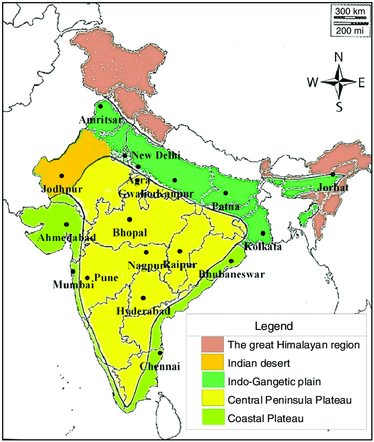
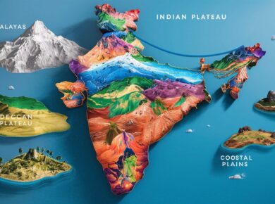
India Physiography – The Indian Peninsular Plateaus

India can be divided into following physical divisions viz.
- The Northern Mountains
- The North Indian Plain
- The Peninsular Plateau
- Great Indian Desert
- The coastal Regions
- Islands
The Peninsular Plateaus
- Largest of India’s physical divisions – Comprises of broad & shallow valleys with rounded hills.
- Triangular in shape; composed of the oldest rocks & surrounded by hills.
- Narmada – Tapi divides it into 2 parts viz. Central highland & Deccan plateau.

Division of Peninsular Plateau |
|
The Central Highland
|
The Deccan Plateau
|
The Central Highlands
- Lies to the north of the Narmada River between Aravali in North & Vindhya range in south
- Covers the major portion of the Malwa plateau (Madhya Pradesh)
- Rivers in this region flow from southwest to northeast, which indicates the slope of this region
- Further extension of it is Bundelkhand, Bhaghelkhand & Chhota Nagpur Plateau
- Chambal & Betwa flows through it > Region known as Bedland (Not fit for cultivation)
| Malwa Plateau |
|
| Bundelkhand Plateau |
|
| Chhotanagpur Plateau |
|
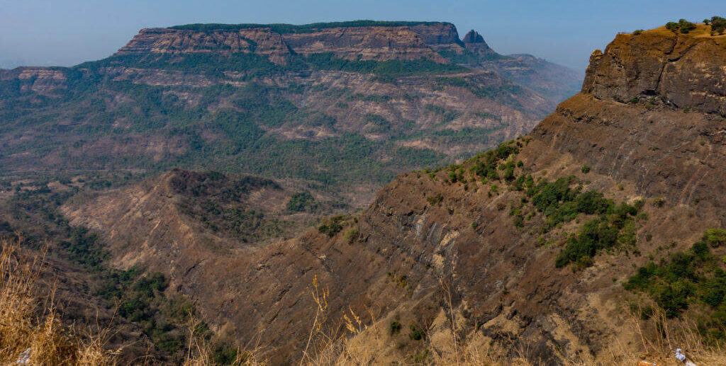
Deccan Plateau
- Largest plateau in India; Lies to the south of the Narmada River; Shaped as inverted triangle.
- Surrounded by Satpura hills, Mahadeo hills, Maikala range, Amarkantak hills and Rajmahal hills in the north; Western Ghats in the west and the Eastern Ghats in the east
- Volcanic in origin, made up of horizontal layers of solidified lava forming trap structure with step like appearance.
- Sedimentary layers are also found in between the layers of solidified lava, making it inter-trapping in structure.
- Average elevation of Western Ghats is 900 – 1600 metres; compared to 600 metres of Eastern Ghats
- Slopes towards east and south and descends abruptly towards west making sahayadri ranges.
- The plateau is suitable for the cultivation of cotton; home to rich mineral resources & a source to generate hydroelectric power.
Also read: India Physiography – The Northern Mountain Himalayas
Western Ghats
- Folded parts of Deccan Plateau
- Also known as Shayadries
- More Continuous & higher than Eastern Ghats
- Separated from coast by narrow coastal plains
- Rich watersheds give birth to large peninsular rivers like Godavari and Krishna
- Extends from Tapi in North to Kanyakumari in south.
Important Passes (Rail Links)
- Thalghat > Mumbai —- Kolkata
- Bhorghat > Mumbai —- Chennai
- Phalghat > Kochi ——– Chennai
Important Hill Ranges
- Nilgiri Range (Highest peak) > Doda Betta along ooty (Udhagmandalam) > TN
- Highest Peak of South India > Anaimudi From which 3 ranges radiates in 3 directions.
- Cardmom Hills to south
- Anamalai hills to north
- Palni to North East
Eastern Ghats
- Extends from Odisha to North of Nilgiri hills.
- Discontinuous & lower than Western Ghats
- Do not give birth to important rivers like western ghats
- Separated from coast by very wide coastal plains
- Geologically older than western ghats
- Mahanadi, Godavari, Krishna, Kaveri cut through this range to merge with Bay of Bengal
- The Western Ghats and the Eastern Ghats meet in the Nilgiri hills.
Telangana Plateau
|
Karnataka Plateau
|
Dandakaranya Plateau
|
Shillong Plateau
|
For more updates, explore the Geography . Feel free to share your thoughts and comments.
If you’re passionate about building a successful blogging website, check out this helpful guide at Coding Tag – How to Start a Successful Blog. It offers practical steps and expert tips to kickstart your blogging journey!


5 comments
Liner’s the BEST!!!
I’ve just started using it and I totally love it !!
It’s just perfect for me …everything is worked out in just one scan !!!
Thanks Liner ! You’ve made my life filled with fun!
thankyou very much to share the knowledge.
Perfect….
really helpful!!
The notes are easy to refer and to the point. Good work.