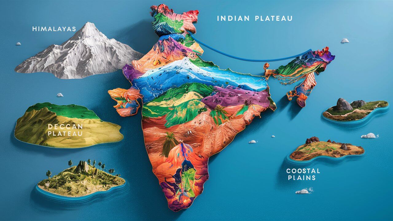
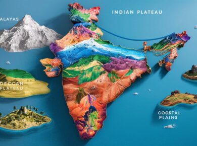
India Physiography – Indian Desert, Coastal regions, Indian Islands

India can be divided into following physical divisions viz.
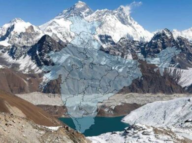
- The Northern Mountains
- The North Indian Plain
- The Peninsular Plateau
- Great Indian Desert
- The coastal Regions
- Islands
The Great Indian Desert
- Extends from the western margins of the Aravali Hills
- Luni is the only prominent river

The Coastal regions
- Excluding the islands, the mainland of India has 6,100 kms length of coastline
- Extends from Kutch in Gujarat in the west to the Gangetic delta in the east
- The coast of India is divided into western coast and eastern coastal plains.
- The coastal regions of India are known for agriculture, trade, industrial centres, tourist centres, fishing and salt making
- They also provide important hinterlands for the ports

Western Coastal Plains
- Lies between Western Ghats & Arabian sea from Gujrat in north to Kanyakumari in south
- Narrower & wetter than Eastern plains
- Divided into Malabar coast, Kannada Coast, Konkan coast, Kanyakumari Coast, Kachchh and Kathiawad peninsulas
- Kathiawar Coast > Kutch to Daman (Tapti, Narmada, Sabarmati & Mahi River deposit huge load of sediments in the Gulf of Cambay & form estuaries)
- Konkan Coast > Between Daman & Goa
- Kannada Coast > Goa to Cannanore
- Kanyakumari Coast > Cannanore to Cape Camorin
- Malabar Coast > Kannada + Kanyakumari Coast
- Important Ports > Mumbai, Marmagoa, Cochin, Mangalore, Nhava-Sheva and Kandla
- Marked with Lagoons > Ashtamudi & Vembanad called Kayals > Kerala
Eastern Coastal Plains
- Lies between Eastern Ghats & Bay of Bengal from Gangetic delta in north to Kanyakumari in south.
- Known as Land of Deltas viz. of Mahanadi, Krishna, Kaveri & Godavari
- Broader but drier than Western plains
- Consists of following sub coasts
- Utkal Coast > Deltaic plains of Ganga to Mahanadi delta (Famous Chilka lake is located in this plain)
- Andhra Coast > Utkal plains to Pulicat lake (Contains deltas of Godavari & Krishna Rivers, & famous Kolleru lake)
- Northern Circars > Utkal Coast + Andhra Coast (Between Mahanadi & Krishna)
- Coromandal Coast > Between Krishna & Kanyakumari (Consist of Kaveri Delta)
- Freshwater Kolleru Lake > Between Godavari & Krishna
- Marked with Famous Lagoons → Chilka lake (Orissa) & Pulicat (Tamilnadu)
- Chilka Lake is the largest salt water lake in India
- It lies in the state of Odisha, to the south of the Mahanadi Delta
Indian Islands
- Total 247 islands in India > 204 islands in Bay of Bengal and 43 in the Arabian Sea
- Few coral islands in the Gulf of Mannar also
- Andaman and Nicobar Islands in Bay of Bengal consist of hard volcanic rocks
- The middle Andaman and Nicobar Islands are the largest islands of India
- Lakshadweep islands in the Arabian Sea are formed by corals
- The southern – most point of India is in Nicobar Island, known as Indira Point
- Formerly Indira point was called Pigmalion Point, it is submerged now, after 2004 Tsunami

Andaman & Nicobar Islands |
Lakshadweep Islands |
|
|
Prominent Indian Islands |
|
| A & N Islands | Continuation of Arakan Yoma mountain range of Myanmar |
| Nicobar | Just 147 km from Sumatra island (Indonesia) |
| Saddle Peak | Highest Peak of Andaman |
| Pamban Island | Between India & Srilanka |
| Salasette | Group of 7 islands, known as Mumbai today |
| Diu | Fishing Island |
| New Moore Island | Disputed site b/w India & Bangladesh |
| Wheeler Island | Missile launching island in BOB > Near Odisha coast |
| Sriharikota | Split Island > Rocket launching site in BOB in Andhra Pradesh |
| Wellington | Naval Station > Kerala |
Significance of Indian Ocean for India
- Strategic significance > India overlooks some of the most important sea lanes viz. Suez Canal, Malacca Strait
- Economic significance > Long coastline, 2.02 million sq km EEZ (Exclusive economic zone)
- Tourism Significance > Marine biodiversity and rich ecosystem with coral reefs, mangroves
- Large Fishing potential, Wave energy & Tidal energy potential, Zone of Hydrocarbons
- Generation of south west Monsoon
For more updates, explore the Geography . Feel free to share your thoughts and comments.
If you’re passionate about building a successful blogging website, check out this helpful guide at Coding Tag – How to Start a Successful Blog. It offers practical steps and expert tips to kickstart your blogging journey!


4 comments
thankyou very much to share the knowledge.
sir , i think largest saltwater lake is sambhar lake not chilka lake.
chilka lake is largest salt water lake…
chilka is the largest brackish(partially saline) water lake,while sambar of rajasthan is the largest inland salt water lake.