Types of Satellites
- Satellite refers to a machine that is launched into space and moves around Earth or another body in space.
- A satellite is an artificial object which has been intentionally placed into orbit.
- Such objects are sometimes called artificial satellites to distinguish them from natural satellites such as Earth’s Moon & Sun’s Earth
Why we need satellites?
- Satellites have allows us to see large areas of Earth at one time.
- This ability means satellites can collect more data, more quickly, than instruments on the ground.
- Satellites also can see into space better than telescopes at Earth’s surface.
- Reason being that satellites fly above the clouds, dust and molecules in the atmosphere that can block the view from ground level.
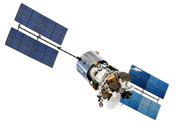
Parts of a Satellite
- All satellites have at least two parts in common – an antenna and a power source.
- The antenna sends and receives information, often to and from Earth
- The power source can be a solar panel or battery

- Many satellites carry cameras and scientific sensors.
- Sometimes these instruments point toward Earth to gather information about its land, air and water
- Other times they face toward space to collect data from the solar system and universe
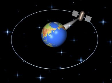
How Do Satellites Orbit Earth?
- A satellite orbits Earth when its speed is balanced by the pull of Earth’s gravity.
- Without this balance, the satellite would fly in a straight line off into space or fall back to Earth.
- Satellites orbit Earth at different heights, different speeds and along different paths. The two most common types of orbit are Geostationary and Polar

- A geostationary satellite travels from west to east over the equator. It moves in the same direction and at the same rate Earth is spinning.
- From Earth, a geostationary satellite looks like it is standing still since it is always above the same location.
- Polar-orbiting satellites travel in a north-south direction from pole to pole. As Earth spins underneath, these satellites can scan the entire globe, one strip at a time
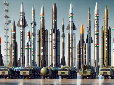
Types of Satellites
- Satellites can be classified by their function since they are launched into space to do a specific job.
- For ex. satellite that is launched to monitor cloud patterns for a weather station will be different than a satellite launched to send television signals.
- Below mentioned are few of the most regular types of satellites launched into space
Communication Satellites
- Communications satellites allow radio, television, and telephone transmissions to be sent live anywhere in the world.
- The purpose of communications satellites is to relay the signal around the curve of the Earth allowing communication between widely separated points
- Communication Satellites use Microwaves and Radio waves for transmitting signals
Before communication satellites, transmissions were difficult or impossible at long distances. The signals, which travel in straight lines, could not bend around the round Earth to reach a destination far away. Now as communication satellites are in orbit, the signals can be sent instantaneously into space and then redirected to another satellite or directly to their destination.
- There are two major classes of communications satellites, passive and active
- Passive > bouncing signals from the Earth back to another location on the Earth
- Active > carry electronic devices called transponders for receiving, amplifying, and re-broadcasting signals to the Earth
Communications satellites India
- Indian National Satellite (INSAT) Series
- GSAT Satellites Series
Navigation satellites
- A system of satellites that provide autonomous geo-spatial positioning with global coverage
- Designed expressly to aid the navigation of sea and air traffic via. Radio waves
- It allows small electronic receivers to determine their location to high precision using time signals transmitted along a line of sight by radio from satellites
- A satellite navigation system with global coverage may be termed a global navigation satellite system (GNSS)
- Currently Global Positioning System (GPS) and the Russian GLONASS are only globaly operational GNSSs
- China is in the process of expanding its regional BeiDou Navigation Satellite System into the global Compass navigation system by 2020.
- European Union’s Galileo is a GNSS in initial deployment phase, scheduled to be fully operational by 2020
- Japan is developing a regional based navigation system viz. Quasi-Zenith Satellite System
India has a regional satellite-based augmentation system, GPS Aided GEO Augmented Navigation (GAGAN), which enhances the accuracy of NAVSTAR GPS and GLONASS positions, and is developing the Indian Regional Navigation Satellite System (IRNSS)
Remote Sensing Satellites
- Remote sensing is observing and measuring our environment from a distance viz. earth observation satellites
- The electromagnetic radiation is normally used as an information carrier in remote sensing.
- The output of a remote sensing system is usually an image representing the scene being observed.
The data from these satellites are used for several applications covering agriculture, water resources, urban planning, rural development, mineral prospecting, environment, forestry, ocean resources and disaster management.
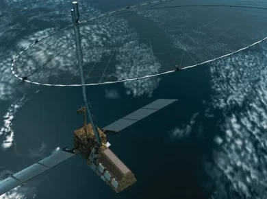
Remote Sensing Satellites India
- Indian Remote sensing (IRS) satellite series
- Cartosat; Oceansat; & RISAT (Resource Sat) Satellites
- Bhaskara Satellites; Megha-Tropiques Satellites
- Satellite with ARgos and ALtiKa (SARAL)
Space Exploration Satellites
- Space exploration satellites are not really satellites at all; they are properly known as space probes.
- Space probes send back detailed pictures and atmospheric data of planets and other stellar phenomena
- Space exploration satellites must be built to last because it takes so long for the satellites to reach their destinations.
- Jupiter’s rings were discovered by a space exploration satellite
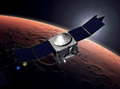
Space Exploration Satellites India
- Stretched Rohini Satellite Series (SROSS)
- Chandrayaan 1
- Mars Orbiter Mission – Mangalyaan
For more updates, explore the Sci Tech. Feel free to share your thoughts and comments.
If you’re passionate about building a successful blogging website, check out this helpful guide at Coding Tag – How to Start a Successful Blog. It offers practical steps and expert tips to kickstart your blogging journey!


2 comments
you are awsome, there are no other words for your efforts .thank you very much .hats off
Thank you Roy