Mountain Ranges in India
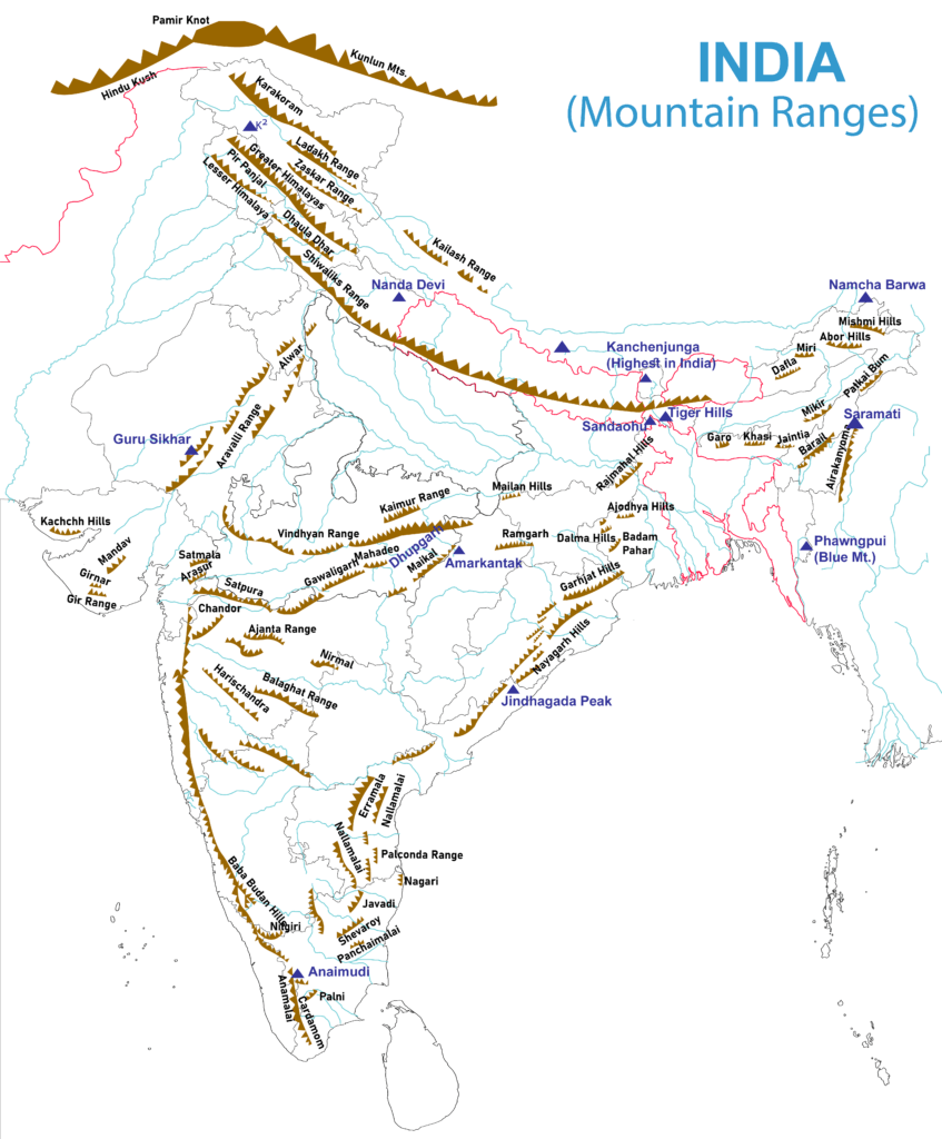
| Karakoram Range |
- A sub range of the Hindu Kush Himalayan Range
- K2, the second highest peak in the world is located here
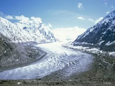
- Famous Glaciers: Siachen Glacier, Biafo Glacier
- Karakoram range span the borders between Pakistan, India and China
- Located in the regions of Gilgit – Baltistan (Pakistan), Ladakh (India), and Xinjiang region (China)
|
| Ladakh Range |
- South-eastern extension of the Karakoram Range
- From the mouth of the Shyok River in Ladakh to the border with Tibet
- Extension of the Ladakh Range into China is known as Kailash Range
- Lies here India’s cold desert named as ‘LEH
|
| Zaskar Range |
- Boundary line between Ladakh region of Kashmir & remaining two regions of the state i.e. Jammu region and Vale of Kashmir
- Highest peak Kamet (UK)
- Lies here Coldest place in India, Dras (The Gateway to Ladakh)
- Famous Passes: Shipki, Lipu Lekh (Lipulieke), and Mana Pass
|
| Pirpanjal Range |
- Separates Jammu Hills to the south from the Vale of Kashmir (Kashmir Valley), beyond which lie the Great Himalayas
- Highest Point: Indrasan, 2nd Highest: Deo Tibba
- Has India’s longest rail tunnel known as Pir Panjal Railway Tunnel, Banihal road tunnel
- Famous Passes: Pir Panjal Pass, Banihal Pass, Rohtang pass
|
| Dhauladhar Range (White Range) |
- Spread in J & K and Himachal, with home to major hill stations like Kullu, Manali & Shimla
- Highest peak: Hanuman ji Ka Tiba, or ‘White Mountain‘
|
| Shivalik Range |
- Southernmost & outer Himalayas also known as Manak Parbat in ancient times, literally means ‘tresses of Shiva’
- About 2,400 km long from Indus till Brahmaputra, with a gap of about 90 kilometres between the Teesta and Raidak rivers in Assam known as sub-Himalayas.
|
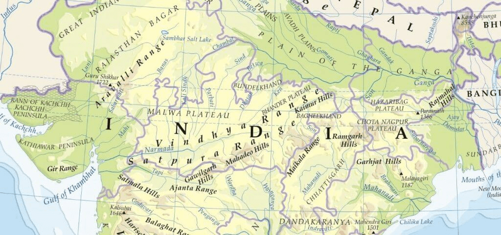
| Aravali Range |
- Means ‘line of peaks’, runs across Gujarat, Rajasthan, Haryana & Delhi, known as Mewar hills.
- Highest Peak: Gurushikhar, Mt abu
- Famous passes: Pipli Ghat, Haldi Ghat
- Locally known as Mewar hills
|
| Maikal Range |
Eastern part of the Satpuras range (MP) |
| Kaimur Range |
Eastern portion of the Vindhya Range in MP, UP & Bihar, Parallel to river son |
| Mahadeo Range |
- forms the central part of the Satpura Range, located in MP
- Highest peak: Dhoopgarh
|
| Ajanta Range |
Maharashtra, south of river Tapi, sheltering caves of world famous paintings of Gupta period |
| Rajmahal Hills |
- In Jharkhand made up of lava basaltic rocks
- Point of Ganges bifurcation
|
| Garo Khasi Jaintia Hills |
Continuous Mountain range in Meghalaya |
| Mikir Hills |
- a group of hills located to the south of the Kaziranga National Park (Assam)
- a part of the Karbi Anglong Plateau
|
| Abor Hills |
- Hills of Arunachal Pradesh, near the border with China, bordered by Mishmi and Miri Hills
- drained by Dibang River, a tributary of the Brahmaputra
|
| Mishmi Hills |
- in Arunachal Pradesh with its northern & eastern parts touching China
- Situated at the junction of North-eastern Himalaya and Indo-Burma ranges.
|
| Patkai Range |
- Also known as Purvanchal Range, consist of three major hills The Patkai-Bum, the Garo-Khasi-Jaintia and Lushai Hills
- situated on India’s north-eastern border with Burma
|
| Mizo Hills (Lushai Hills) |
part of the Patkai range in Mizoram and partially in Tripura |
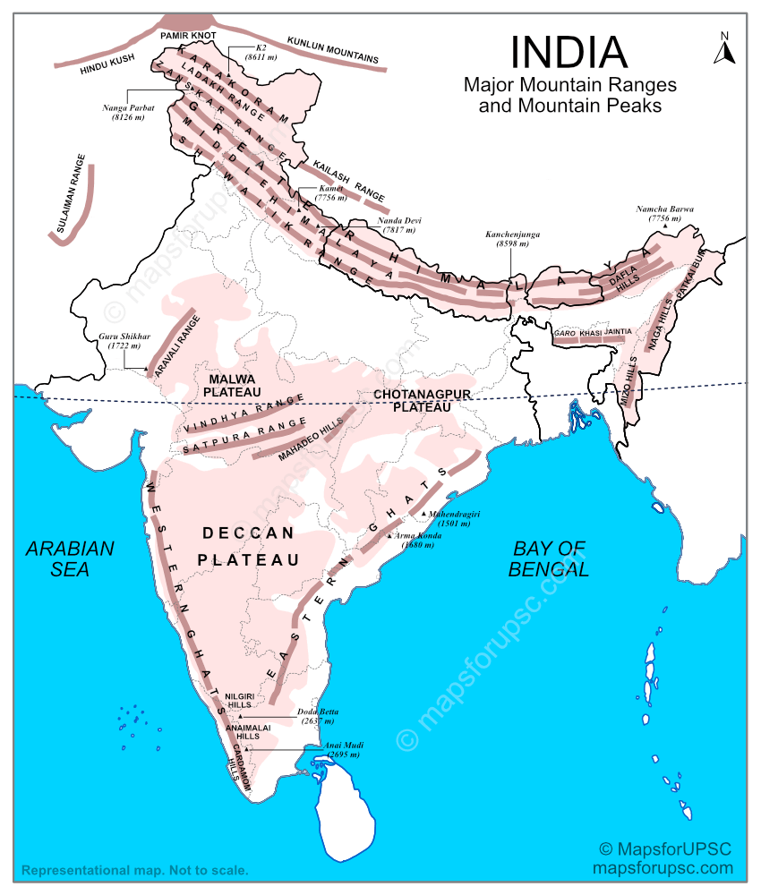
| Vindhya Range |
- a complex, discontinuous chain of mountain ridges, hill ranges, highlands & plateaus running through Madhya Pradesh, Gujarat, Uttar Pradesh and Bihar
- Highest peak – Sadbhawna Shikhar
|
| Satpura Range |
- a range of hills in central India
- Passes through Madhya Pradesh, Gujrat, Maharashtra, Chhattisgarh
- Highest peak: Dhupgarh
|
| Dalma Hills |
- Located in Jamshedpur
- famous for Dalma national park & minerals like iron ore & manganese
|
| Girnar Hills |
Gujrat |
| Baba Budan Giri |
Karnataka |
| Harishchandra |
- At Pune, acts as a water divide bw Godavari & Krishna
- Hills made up of lava
|
| Balaghat range |
Bw MP & Maharashtra, famous for manganese deposits |
| Chilpi series |
MP |
| Talcher series |
Odisha, rich in bituminous coal |
| Champion series |
Karnataka, Dharawar period, rich in gold (contains kolar mines) |
| Nilgiri Hills |
- Referred as Blue mountains, a range of mountains in the westernmost part of Tamil Nadu at the junction of Karnataka and Kerala
- Hills are separated from the Karnataka plateau to the north by the Moyar River and from the Anaimalai Hills & Palni Hills to the south by the Palghat Gap
|
| Palani Hills |
- Eastward extension of the Western Ghats ranges
- adjoin the high Anamalai range on the west, and extend east into the plains of Tamil Nadu
|
| Anamalai Hills |
- Also known as Elephant Hill
- a range of mountains in the Western Ghats in Tamil Nadu and Kerala with highest peak Anamudi
|
| Cardmom Hills |
Part of the southern Western Ghats located in southeast Kerala and southwest Tamil Nadu |
| Pachamalai Hills |
- Also known as the Pachais
- Eastern Ghats in Tamil Nadu
|
For more updates, explore the Geography . Feel free to share your thoughts and comments.
If you’re passionate about building a successful blogging website, check out this helpful guide at Coding Tag – How to Start a Successful Blog. It offers practical steps and expert tips to kickstart your blogging journey!

1 comment
kya randapa macha rakha hai madarchod, jyaada gaand na phulao, maa chod denge tumhari.