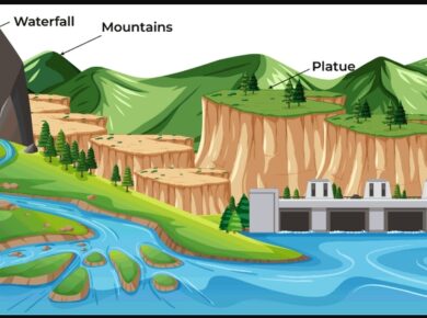
Landforms of Lowland Glaciation
Most of the glaciated lowlands have depositional features, but where rock masses project above the level surface, they result in striking features of erosion.
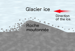
Roche Moutonnee
- Basically, a resistant residual rock hummock or mound, striated by the ice movement.
- Its upstream or stoss side is smoothened by abrasion & its downward or leeward side is roughened by plucking & is much steeper.
- It is believed that plucking may have occurred on leeward side due to a reduction in pressure of the glacier moving over the stoss slope
- Therefore, providing the opportunity for water to refreeze on the lee side and pluck the rock away.
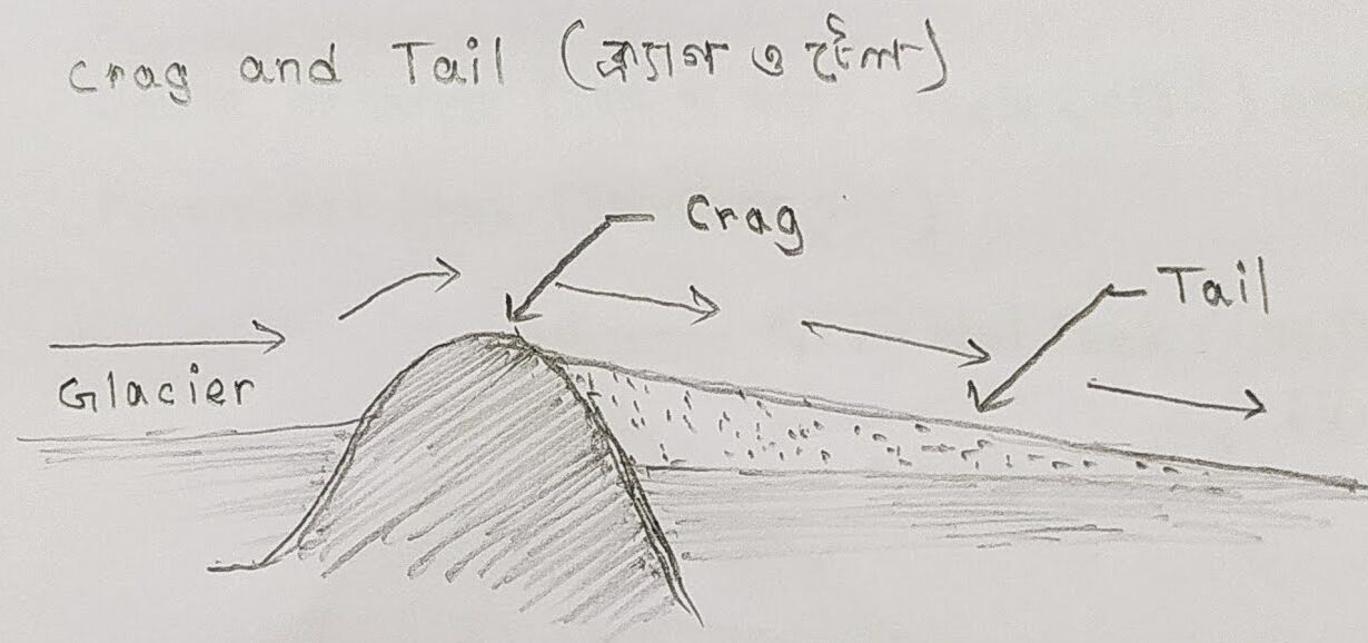
Crag & Tail
- A crag and tail is a larger rock mass than a Roche moutonnee.
- Like a Roche moutonnee, it is formed from a section of rock that was more resistant than its surroundings.
- Crag is a mass of hard rock with a steep slope on the upward side, which protects the softer leeward slope from being completely worn down by the oncoming ice.
- It therefore has a gentle tail strewn with the eroded rock debris.
Boulder clay or Glacial till
- This is an unsorted glacial deposit comprising a range of eroded materials such as boulders, sticky clays & fine rock flour.
- It is spread out in sheets, not mounds, & forms gently undulating till or drift plains with monotonous landform.
- The degree of fertility of such glacial plains depends very much on the composition of the depositional materials.

Erratics
- Boulders of varying size that are transported by ice & left stranded in the regions of deposition when the ice melted.
- Called erratics because they are composed of the materials entirely different from those of the regions in which they have been transported.
- Useful in tracing the source & direction of ice movements but their presence in large numbers causes hindrance in farming.
- Also known as perched blocks as sometimes they are found perched in precarious positions as the ice dropped them.
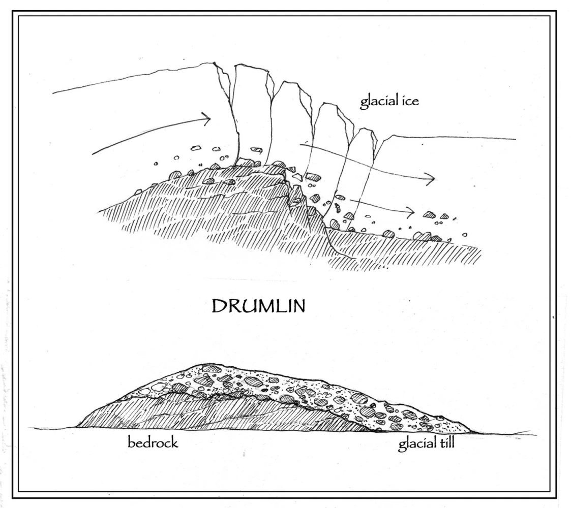
Drumlins
- Elongated whale back type hummocks composed wholly of boulder clay with elongation in the direction of ice flow i.e., on the downward side.
- They are low hills upto 1.5 km long and 60 mm tall & appear steeper on the onset side & taper off at leeward side.
- They are arranged diagonally & commonly referred as basket of eggs topography.
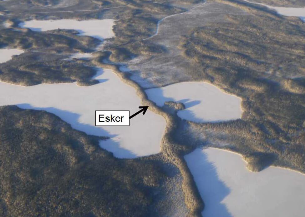
Eskers
- Eskers are the sinuous ridges composed of glacial material mainly sands & gravel deposited by meltwater currents in glacial tunnels
- Glacial tunnels marks the former sites of sub glacial melt water streams
- Their orientation is generally parallel to the direction of glacial flow, and they sometimes exceed 100 kilometres in length.
Outwash Plains
- Made up of fluvio glacial deposits washed out from the terminal moraines by the streams of stagnant ice mass.
- The melt waters sort & redeposit the material mainly consisted of layers of sand and other fine sediments.
- Such plains with their sandy soils are often used for specialized kinds of agriculture, such as the potato.
Kettle lake
- A depressions formed when the deposition takes place in the form of alternating ridges
- Shallow, sediment filled body of water formed by retreating glaciers
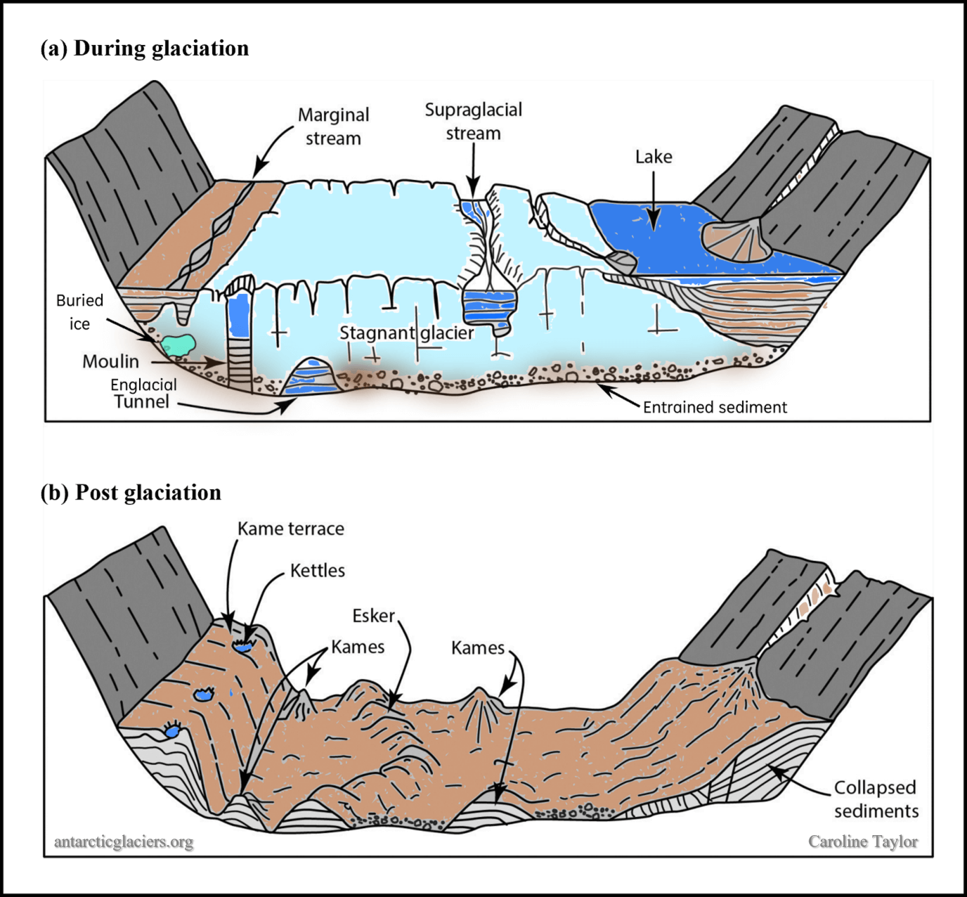
Kames
- Small, rounded hillocks of sand & gravel which cober part of the plain
- Kames are often associated with kettles, and this is referred to as kame & kettle topography.
For more updates, explore the Geography . Feel free to share your thoughts and comments.
If you’re passionate about building a successful blogging website, check out this helpful guide at Coding Tag – How to Start a Successful Blog. It offers practical steps and expert tips to kickstart your blogging journey!