Landforms of Highland Glaciation
- Glaciation generally gives rise to erosional features in the highlands & depositional features on lowlands.
- It erodes its valley by two processes viz. plucking & abrasion.
- Plucking >> Glacier freezes the joints & beds of underlying rocks, tears out individual blocks & drags them away.
- Abrasion >> Glacier scratches, scrapes, polishes & scours the valley floor with the debris frozen into it.
Characteristic features of Glaciated Highland
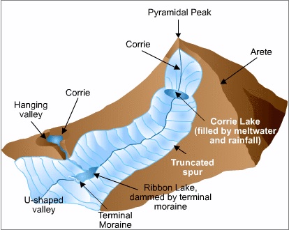
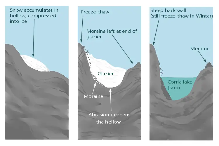
Corrie, Cirque or cwm
- The downslope movement of a glacier from its snow-covered valley head & the intensive shattering of the upland slopes, tend to produce a depression where neve or firn accumulate.
- Plucking & abrasion further deepen the depression into a steep horseshoe shaped basin called Cirque (in French), cwm (in Wales) & Corrie (in Scotland)
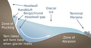
- There is a rocky ridge at the exit of the corrie & when the ice eventually melts, water collect behind this barrier known as Corrie Lake or tarn.
Aretes and Pyramidal Peaks
- When two corries cut back on opposite sides of the mountain, knife edged ridges are formed called aretes
- When three or more cirques cut back together, recession will form an angular horn or pyramidal peak

Bergschrund
- At the head of a glacier, where it begins to leave the snowfield of a corrie, a deep vertical crack opens up called a Bergschrund or Rimaye
- This happens in summer when although the ice continues to move out of the corrie, there is no new snow to replace it
- In some cases not one but several such cracks occur which present a major obstacle to climbers
- Further down, where the glacier negotiates a bend or a precipitous slope, more crevasses or cracks are formed
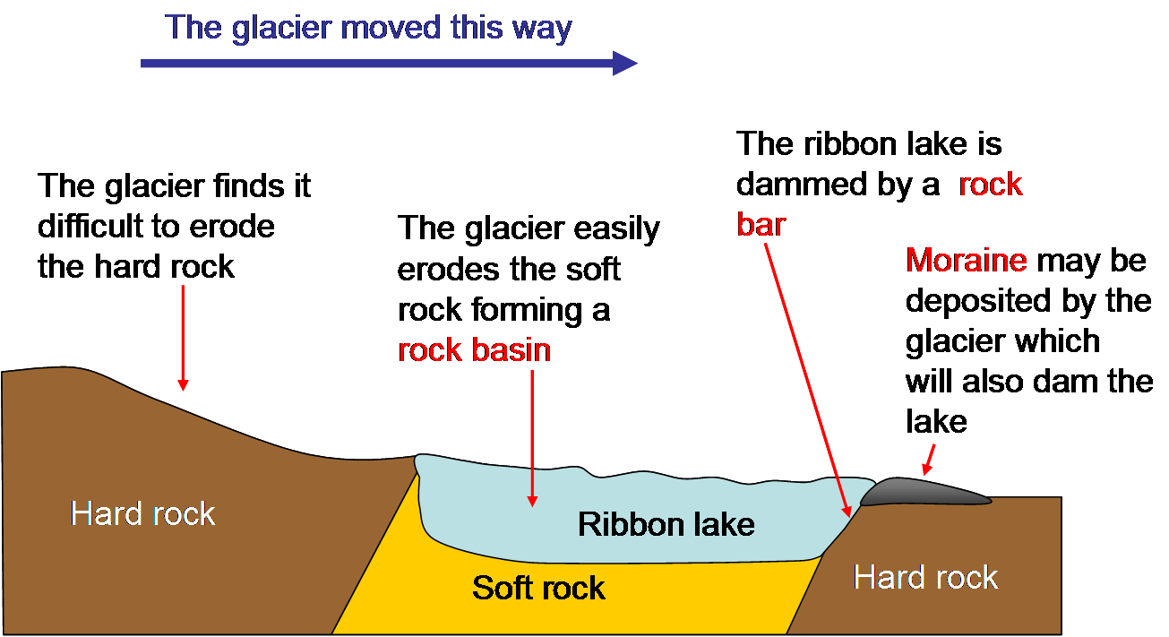
U Shaped Glacial Troughs & Ribbon Lakes
- Glaciers on their downward journey are fed by several corries scratches & grind the bedrock with straightening out any portruding spurs.
- The interlocking spurs are thus blunted to form truncated spurs with floor of the valley deepened.
- Hence, the valley which has been glaciated takes the characteristic U shape, with a wide flat floor & very steep sides.
- After the disappearance of the ice, the deep sections, of these long, narrow glacial troughs may be filled with waterforming Ribbon lakes also known as Trough lakes or Finger Lakes.
Hanging Valleys
- The main valley is eroded much more than the tributary valley as it contains much larger glacier.
- After the ice has been melted, a tributary valley hang above the main valley & plunges down as waterfall. Such Tributary valleys are termed as Hanging valleys.
- Hanging valleys may form a natural head of water for generating hydroelectric power.

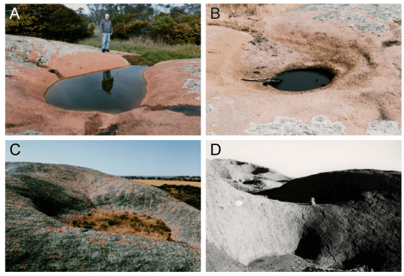
Rock Basins and Rock Steps
- A glacier erodes & excavates the bed rock in an irregular manner.
- The unequal excavation gives rise to many rock basins later filled by lakes in valley trough.
- Where a tributary valley joins a main valley, the additional weight of ice in the main valley cuts deeper into the valley floor & deepest at the point of convergence forming rock steps.
- A series of such rock steps may also be formed due to different degrees of resistance to glacial erosion of the bedrocks.
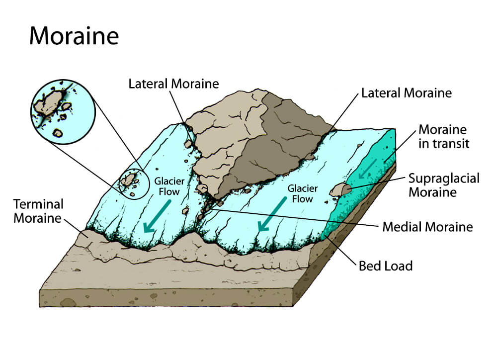
Moraines
- Moraines are made up of the pieces of rock that are shattered by frost action, imbedded in the glaciers & brought down the valley.
- Those that fall on the sides of the glacier form lateral moraines.
- When two glaciers converge, their inside lateral moraines unite to form a medial moraine.
- The rock fragments which are dragged along, beneath the frozen ice, are dropped when the glacier melts & spread across the floor of the valley as ground moraine.
- The glacier eventually melts on reaching the foot of the valley & the pile of transported materials left behind at the snout is terminal moraine or end moraine.
- The deposition of end moraines may be in several succeeding waves, as the ice may melt back by stages so that a series of recessional moraines are formed.
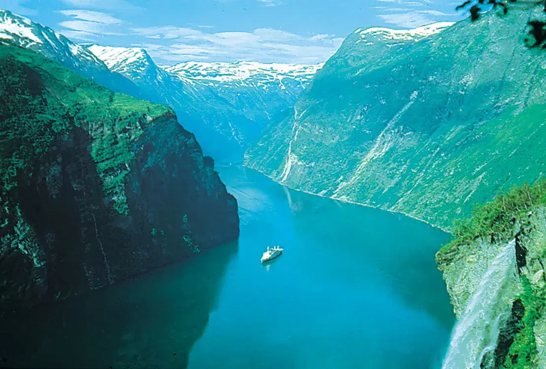
Fjord
- If the glacier flows right down to the sea, it drops its load of moraine in the sea.
- If section break off as icebergs, moraine material will only be dropped when they melt
- Where the lower end of the trough is drowned by the sea, it forms a deep, steep side inlet called a Fjord, a typical of Norway & Chilean coast.
For more updates, explore the Geography . Feel free to share your thoughts and comments.
If you’re passionate about building a successful blogging website, check out this helpful guide at Coding Tag – How to Start a Successful Blog. It offers practical steps and expert tips to kickstart your blogging journey!
2 comments
Nice job
I LIKE IT…!!!